The Rock Formations of Los Haitises National Park: Limestone Layers, Natural Structures and Geological History
Los Haitises National Park is one of the most distinctive geological landscapes in the Dominican Republic. Its rugged limestone hills, steep rock faces, coastal cliffs, natural caves and unusual depressions create a landscape that looks very different from many other tropical environments.
These formations are not simply ordinary hills made of stone. They are the result of a long geological history involving marine sedimentation, the accumulation of carbonate material, the emergence of ancient seabeds and the gradual dissolution of limestone by water.
The park's characteristic hills are known as mogotes. Between them are depressions and valleys, while the surrounding coastal landscape contains limestone cliffs, small islands and caves. Below the surface, water has gradually enlarged fractures and openings, creating underground passages and other karst features.
Understanding the rock formations of Los Haitises helps explain how the region developed and why its geology supports such a varied natural environment.
1. What Makes the Rock Formations of Los Haitises Special?
Los Haitises is part of a major karst landscape in eastern Hispaniola. Karst terrain develops when water gradually dissolves soluble rocks, particularly limestone.
The geological landscape includes several recognizable features:
- Limestone hills and mogotes
- Steep rock faces and coastal cliffs
- Depressions between hills
- Fractures and weathered rock surfaces
- Natural caves and underground passages
- Limestone islands and coastal rock formations
- Stalactites, stalagmites and other cave deposits
These features are connected through the same geological system, although each develops through different processes.
The National Geological Service of the Dominican Republic describes the Los Haitises region as an intensely karstified area, with large depressions and characteristic tropical mogotes. Its geological mapping also documents underground karst features, including caves and associated formations.
This combination of surface and underground structures makes Los Haitises an important example of tropical karst terrain.
2. The Geological Foundation: The Los Haitises Formation
The rocks underlying much of the region belong to a geological unit known as the Los Haitises Formation.
Geological research describes this formation as being composed mainly of limestone, with intercalated beds of marly limestone and marl.
These rocks are associated with the Pliocene to Early Pleistocene geological periods.
What is limestone?
Limestone is a sedimentary rock composed mainly of calcium carbonate.
It commonly forms in marine environments where carbonate material accumulates. This material can include the remains and skeletal structures of marine organisms, as well as carbonate mud and other sediment.
Over time, accumulated sediment becomes compacted and cemented into rock.
What is marl?
Marl is a sedimentary material containing a mixture of carbonate and clay-rich components.
Compared with relatively pure limestone, marl generally contains more fine-grained non-carbonate material.
What is marly limestone?
Marly limestone contains both carbonate material and a noticeable proportion of clay-rich components.
The presence of limestone, marly limestone and marl helps explain why the geological structure of the region is not completely uniform.
The different rock layers also respond differently to weathering and erosion.
3. How the Ancient Marine Environment Created the Rocks
The geological history of Los Haitises begins long before the modern national park existed.
During the Pliocene and Early Pleistocene, parts of eastern Hispaniola were covered by shallow marine environments.
Sediments accumulated on a broad marine platform. These included carbonate material and finer sediment transported from nearby land areas.
Marine sediment accumulation
Shallow tropical seas can support the production of carbonate sediment through biological and chemical processes.
Corals, molluscs, echinoids, foraminifers, bryozoans and coralline algae are among the organisms identified in research on the regional carbonate deposits.
Their remains and other carbonate material contributed to the sediments that eventually became limestone.
A changing marine platform
Research by Braga and colleagues describes the Los Haitises and Yanigua formations as deposits that developed across a shallow-water marine platform.
The Yanigua Formation contains more marl and other siliciclastic materials, while the Los Haitises Formation is dominated by limestone with intercalated marly limestone and marl.
This geological arrangement reflects differences in sediment supply and depositional conditions across the ancient platform.
From seabed to exposed landscape
The rocks that formed beneath ancient marine waters later became part of the exposed landscape.
The emergence of marine deposits during the Pleistocene contributed to the development of the present-day land area in eastern Hispaniola.
The limestone hills and coastal formations visible in Los Haitises are therefore connected to an ancient marine geological history.
4. The Limestone Layers of Los Haitises
The rocks of Los Haitises are not necessarily uniform from one location to another.
The geological formation includes limestone beds as well as layers of marly limestone and marl.
These different materials provide clues about the environments in which the original sediments accumulated.
Limestone beds
Limestone forms much of the characteristic rocky landscape.
It is relatively susceptible to dissolution by water, which is one reason why limestone regions commonly develop caves, fractures and depressions.
Marl and marly limestone layers
Marl and marly limestone represent different mixtures of carbonate and fine-grained sediment.
Their physical and chemical characteristics differ from those of relatively pure limestone.
Where these materials occur together, variations in resistance to weathering can influence the shape of exposed rock surfaces.
Why geological layers matter
The arrangement of different rock layers is important for understanding the landscape.
Geologists study these layers to reconstruct ancient environments, identify changes in sediment supply and understand the geological history of a region.
The Los Haitises Formation is therefore more than a collection of limestone hills. It preserves evidence of ancient marine conditions in the Dominican Republic.
5. The Formation of Mogotes: Los Haitises' Characteristic Hills
One of the most recognizable features of Los Haitises is its landscape of mogotes.
Mogotes are steep-sided limestone hills associated with tropical karst environments.
They rise above lower depressions and valleys, creating a rugged landscape with a distinctive pattern of elevated rock masses.
How mogotes develop
Mogotes are associated with the long-term dissolution of limestone.
Rainwater absorbs carbon dioxide from the atmosphere and soil, forming weakly acidic water. As this water moves over and through limestone, it gradually dissolves some of the rock.
Over long periods, differences in rock structure, fractures and water movement contribute to an irregular landscape.
The result can include elevated limestone hills separated by depressions.
A distinctive tropical karst landscape
The National Geological Service describes Los Haitises as a landscape with large dolines and mogotes, characteristic of tropical cockpit karst.
The regional geological report describes some of these depressions as elongated or rounded forms and notes that their dimensions can be substantial.
Why the hills look different
Mogotes do not all have identical shapes.
Their appearance is influenced by geological structure, rock resistance, the distribution of fractures and the long-term action of water.
Some have steep slopes, while others have irregular outlines or uneven surfaces.
The forest vegetation growing across these formations adds another layer to the park's distinctive scenery.
6. Limestone Cliffs and Steep Rock Faces
Los Haitises also contains coastal rock faces and limestone cliffs.
These structures are particularly interesting because they show how geological formations interact with coastal processes.
How cliffs form
Cliffs can develop where erosion and weathering remove material from exposed rock surfaces.
Along coastal margins, wave action can contribute to the erosion of rock, while rainwater and chemical weathering affect exposed limestone.
Over long periods, these processes can create steep rock faces and irregular coastal profiles.
Rock openings and caves
Limestone cliffs may contain openings and cavities connected to karst processes.
Some caves are accessible from the coast, while others form part of the underground drainage system.
The National Geological Service's geomorphological mapping documents caves and associated features within the wider Los Haitises karst region.
A changing coastal landscape
Coastal rock formations continue to be influenced by water, weathering and changes in sea level.
Their present appearance reflects a combination of geological history and more recent coastal processes.
7. Fractures, Cracks and Natural Openings in Limestone
Limestone rocks are often crossed by fractures and joints.
These openings are important because they influence how water enters and moves through the rock.
How fractures develop
Fractures can form through geological stresses and other processes affecting rock masses.
They may create pathways through which water can move.
Over time, the chemical dissolution of limestone can enlarge some of these openings.
Water movement through fractures
Rainwater can enter fractures and gradually dissolve limestone along their surfaces.
As openings become larger, they may develop into connected cavities or underground passages.
Why fractures matter
Fractures influence several aspects of the karst landscape:
- The movement of groundwater
- The development of underground drainage
- The enlargement of natural cavities
- The formation and growth of caves
- The distribution of water through limestone formations
The underground drainage system is therefore closely connected to the visible rock structures above ground.
8. Dolines and Depressions Between the Hills
Another important feature of Los Haitises is the presence of depressions in the limestone landscape.
A doline is a depression formed in karst terrain, commonly through the dissolution of limestone or the collapse of underlying cavities.
The Spanish term dolina is used in Dominican geological reports describing the Los Haitises landscape.
Dissolution dolines
Some depressions develop gradually as water dissolves limestone.
The removal of rock material can create a hollow or basin-like feature at the surface.
Collapse features
In some karst settings, underground cavities can become unstable. If the overlying material collapses, a depression may form at the surface.
Not every depression in Los Haitises should automatically be classified as a collapse doline. Determining its origin requires geological investigation.
Uvalas and larger depressions
When smaller karst depressions expand or become connected, larger and more irregular landforms can develop.
Geological mapping in the Los Haitises region describes dolines and other karst depressions as important parts of the landscape.
Why depressions matter
Depressions influence local drainage and can collect water or sediment.
Some may contain vegetation and wetter ground conditions, while others may drain through underground openings.
Their presence contributes to the park's varied topography.
9. Natural Caves and Underground Rock Structures
The caves of Los Haitises are among the best-known expressions of its limestone geology.
They form as water gradually dissolves limestone and enlarges openings within the rock.
How limestone caves develop
Rainwater absorbs carbon dioxide as it moves through the atmosphere and soil.
This produces weakly acidic water capable of dissolving calcium carbonate.
When water enters cracks and fractures in limestone, it can gradually enlarge them.
Over time, these openings may develop into underground passages and chambers.
Stalactites and stalagmites
Caves can contain deposits known as speleothems.
Two familiar examples are:
- Stalactites: Mineral deposits that hang from cave ceilings.
- Stalagmites: Mineral deposits that grow upward from cave floors.
They form when mineral-rich water enters a cave and deposits calcium carbonate as conditions change.
Where stalactites and stalagmites eventually connect, they can form columns.
Other cave structures
Caves can also contain mineral coatings, flowstone and other deposits.
Their development depends on water movement, mineral content, cave conditions and the passage of time.
Caves as geological records
Cave formations can preserve information about past water movement and environmental conditions.
For this reason, caves are valuable not only as natural attractions but also as geological features that deserve careful protection.
10. Coastal Cays and Isolated Limestone Formations
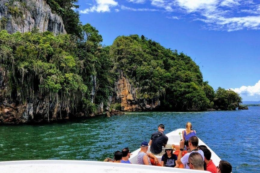
The landscape of Los Haitises includes small coastal islands and rock formations surrounded by water.
These features are often called cays.
Some are associated with the same broader limestone landscape that forms the park's hills and cliffs.
How coastal rock features develop
The shape of a coastal cay can be influenced by the original rock structure, erosion, weathering and changes in sea level.
Some rock masses remain elevated as surrounding areas are modified by coastal processes.
Relationship with mangroves
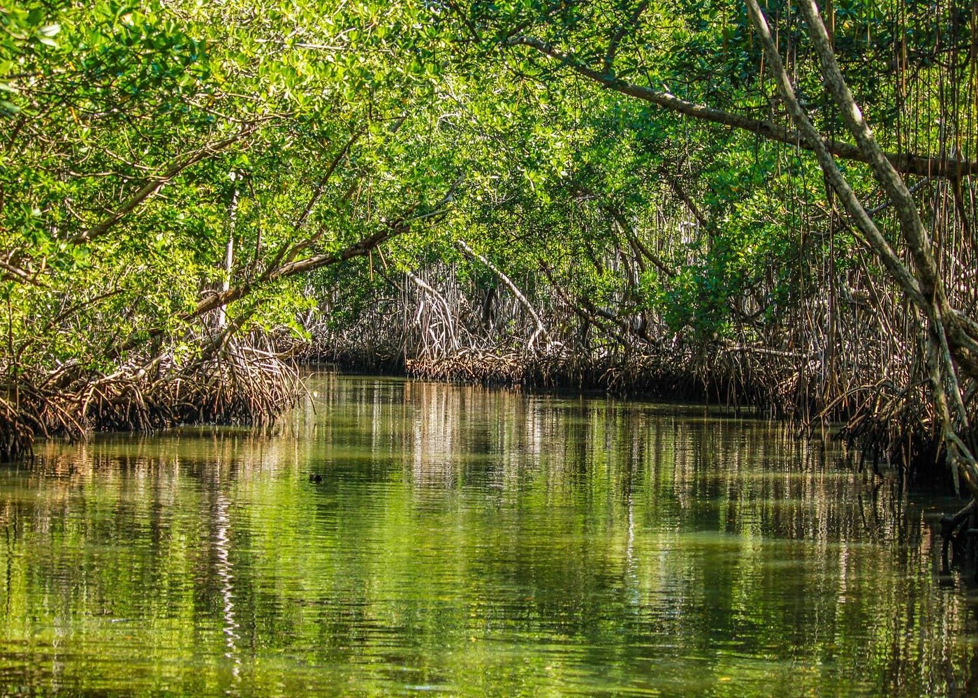
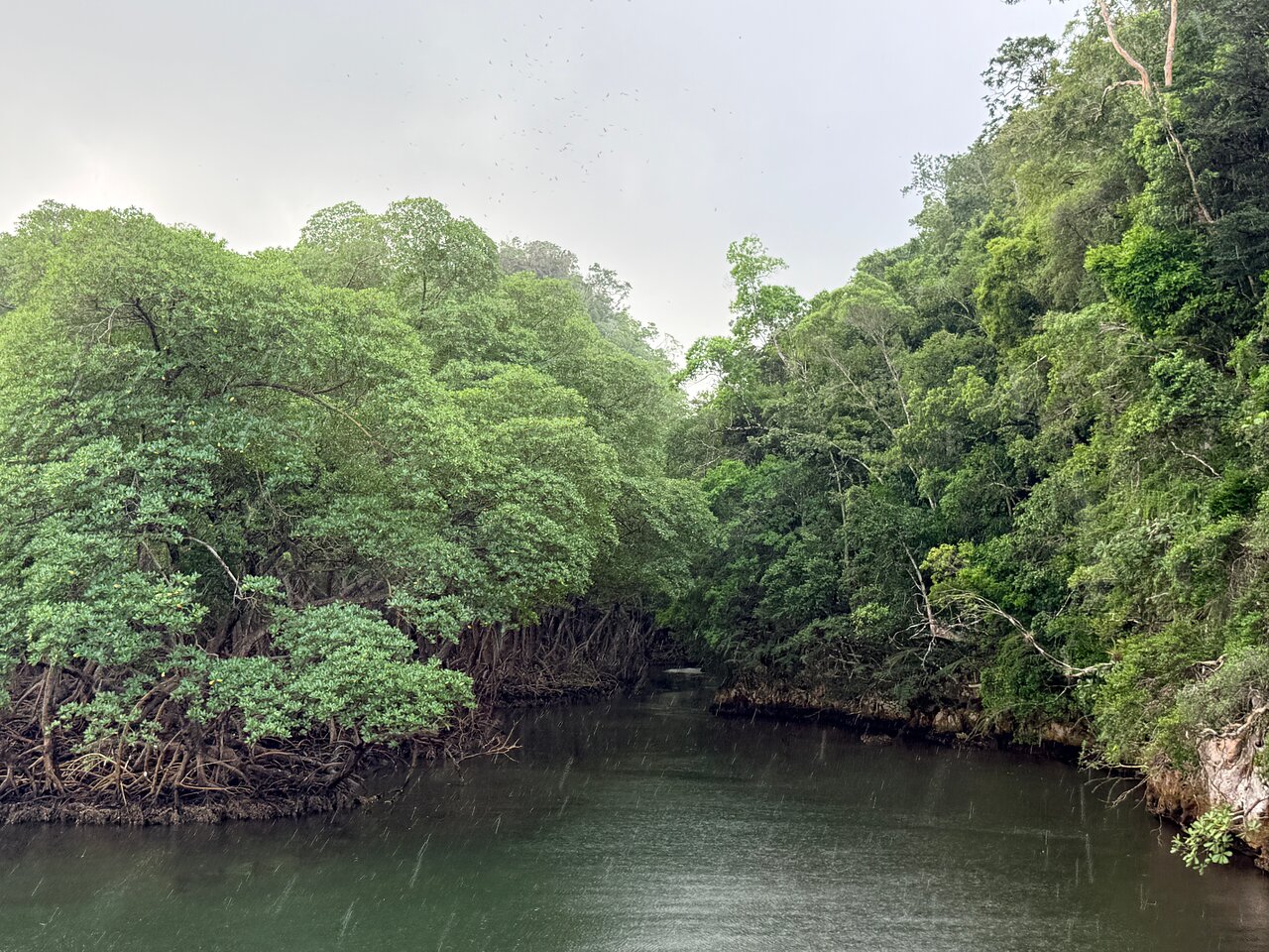
Mangroves grow around many sheltered coastal environments in the park.
Their roots occupy shallow water and muddy shorelines, while nearby limestone formations create the rocky scenery visible during boat excursions.
These habitats are different but can occur close together.
Why cays are important landscape features
Cays contribute to the park's coastal geography and provide a setting for its distinctive scenery.
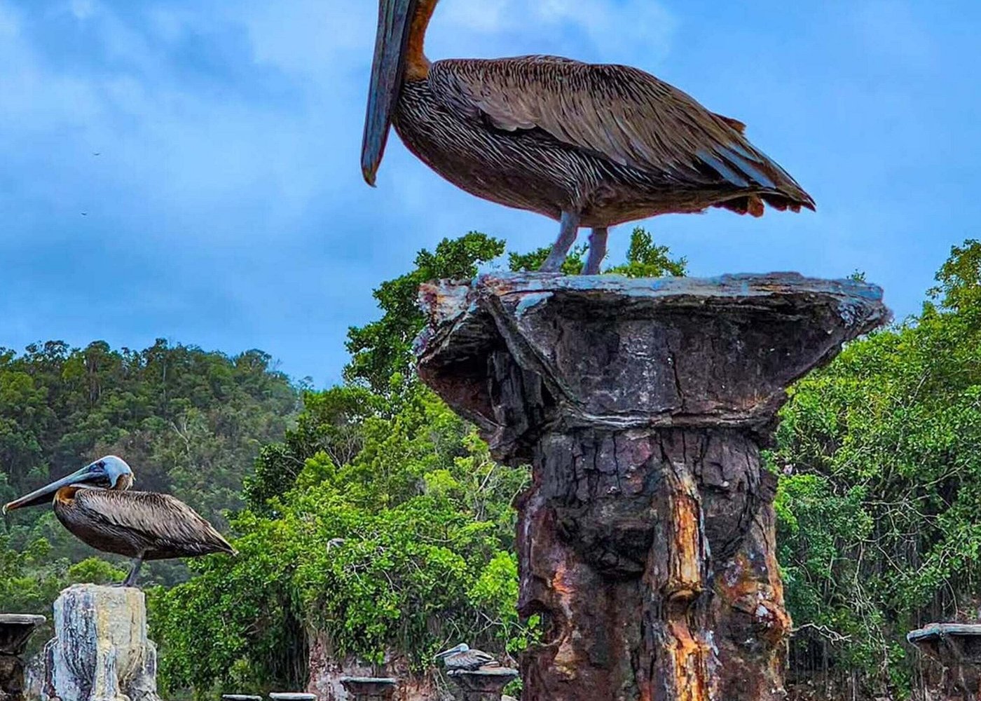
Their surrounding waters and vegetation can also form habitats for birds and other wildlife.
11. How Water Continues to Shape the Rock Formations
The geology of Los Haitises is not only a story about the distant past.
Water continues to interact with the limestone today.
Chemical dissolution
Water moving over and through limestone can dissolve small amounts of calcium carbonate.
This process gradually modifies rock surfaces and underground openings.
Rainfall and surface drainage
Rainfall affects exposed rock surfaces and contributes water to fractures and depressions.
Some water moves over the surface, while some infiltrates the limestone.
Underground drainage
The karst system allows water to move through fractures and cavities.
This can create connections between surface environments, groundwater and springs.
Coastal processes
Along the shoreline, waves and other coastal processes can influence exposed rock surfaces.
The relative importance of these processes varies by location.
Together, these mechanisms help maintain the evolving character of the Los Haitises landscape.
12. Why the Rock Formations Support Different Habitats
The geological structure of Los Haitises influences more than the appearance of the landscape.
Rock formations help create the physical conditions in which different habitats develop.
Forested limestone hills
Mogotes provide elevated surfaces where tropical vegetation can grow in soil pockets and fractures.
Depressions and valleys
Lower areas between hills can collect soil, organic material and water, creating conditions that differ from those on exposed rock.
Coastal cliffs and cays
Rocky coastal features occur alongside mangroves, sheltered waters and other coastal habitats.
Caves and underground environments
Natural caves create sheltered spaces with conditions different from those on the surface.
These habitats form part of the wider ecological diversity of Los Haitises.
13. Protecting the Geological Heritage of Los Haitises
The rock formations of Los Haitises developed over geological timescales. Some features, such as cave mineral deposits, can take a very long time to form.
Once damaged, they may be extremely difficult or impossible to restore to their original condition.
Responsible conservation is therefore essential.
Visitors can help protect the geological environment by following a few simple practices.
Do not scratch or write on rocks. Markings can damage natural surfaces and historical cave features.
Do not remove rocks or mineral deposits. Natural materials should remain part of the protected landscape.
Avoid touching cave formations. Contact can damage delicate mineral deposits or introduce contaminants.
Stay in authorized visitor areas. Some caves and rock formations may have restricted access.
Follow guide instructions. Guides can explain which formations may be visited and how to avoid damaging them.
Do not leave rubbish. Waste can affect the natural environment and wildlife.
The Ministry of Environment's visitor guidance includes rules against scratching cave walls, rocks and trees, as well as removing natural objects.
Conclusion: A Geological Landscape Shaped by Ancient Seas and Water
The rock formations of Los Haitises National Park preserve an important part of the geological history of eastern Hispaniola.
Its limestone foundation formed from ancient marine sediments, while later emergence and karst processes helped create the rugged landscape visible today.
Mogotes, dolines, cliffs, fractures, caves and coastal cays are different expressions of this geological history.
Water continues to influence the landscape through chemical dissolution, underground drainage and coastal processes. These geological features also help create the varied environments that support the park's forests, wetlands and wildlife.
Exploring Los Haitises is therefore an opportunity to appreciate more than its beautiful scenery. It is also a chance to understand how ancient marine environments and long-term geological processes created one of the Dominican Republic's most remarkable natural landscapes.
Frequently Asked Questions
1. What type of rock is most common in Los Haitises National Park?
Limestone is the principal rock associated with the Los Haitises Formation. Geological descriptions also identify intercalated beds of marly limestone and marl.
2. How old are the rocks of Los Haitises?
Research describes the Los Haitises Formation as Pliocene to Early Pleistocene in age. These rocks developed from sediments deposited in ancient shallow marine environments.
3. What are mogotes?
Mogotes are steep-sided limestone hills associated with tropical karst landscapes. They are among the most recognizable geological features of Los Haitises.
4. How were the limestone hills formed?
They developed through long-term geological processes involving limestone deposition, the emergence of ancient marine deposits and the dissolution of limestone by water.
5. What is a doline?
A doline is a depression in a karst landscape. It can form through limestone dissolution or, in some cases, the collapse of material above an underground cavity.
6. Why are there caves in Los Haitises?
Rainwater can dissolve limestone as it enters cracks and fractures. Over long periods, these openings can become larger underground passages and caves.
7. What are stalactites and stalagmites?
Stalactites are mineral deposits hanging from cave ceilings, while stalagmites grow upward from cave floors. Both commonly form through the deposition of calcium carbonate from mineral-rich water.
8. Did the rocks of Los Haitises form underwater?
The geological research indicates that much of the Los Haitises Formation accumulated in an ancient shallow marine environment before the deposits emerged as land.
9. Are the coastal cays made of limestone?
The park's coastal landscape includes limestone formations and cays associated with its karst geology. The composition of an individual cay should be confirmed through location-specific geological information.
10. Can visitors touch or collect rocks and cave formations?
Visitors should not remove natural materials or damage rock and cave surfaces. They should follow park regulations and guide instructions, particularly in caves and other sensitive areas.

Local explorer & expert guide in Whale Miches.